


Namdapha was designated as a Wildlife Sanctuary in 1972, a National Park in 1983, and a Tiger Reserve under the Project Tiger scheme the following year. Its…
Walking through a rainforest with a dense overhead canopy is a beautiful fantasy that everyone must have had at least once in their lives, the canopies created by towering trees whose tops appear to vanish into the sky and tall bamboos whose tops appear magnetically attracted to each other forming long continuous archways through which one can continue trekking, getting a glimpse of the life that lives beneath this awe-inspiring canopy whenever the sun manages to breakthrough.
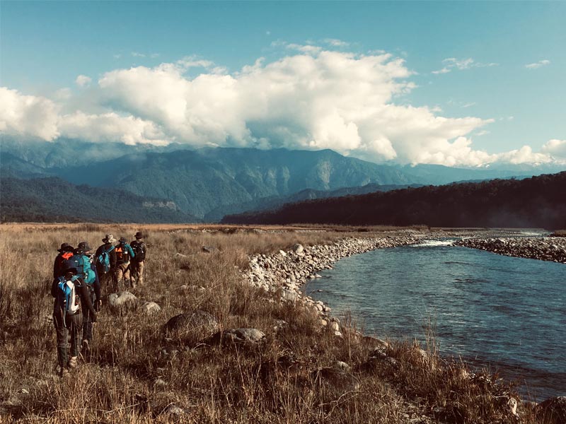
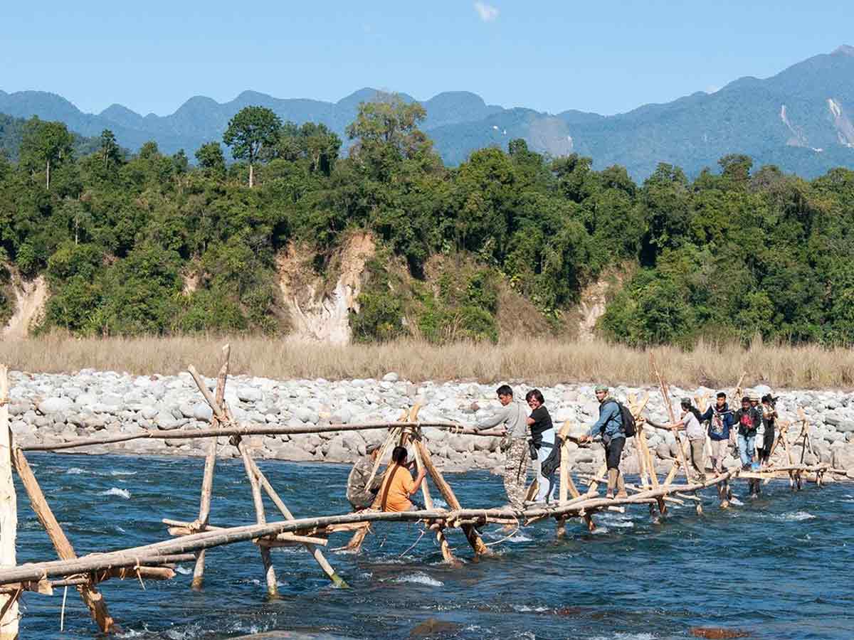
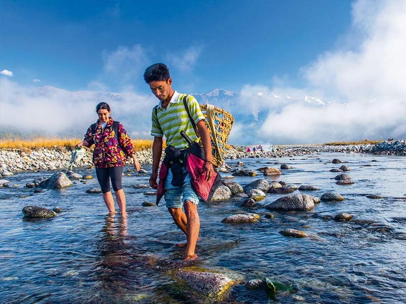
Have you ever wanted to go on a hike through an ecosystem that is home to over 100 mammals, 300 birds, and a thousand other life forms? A forest is so diverse that you can come across it – while crossing streams on rickety footbridges, jumping over large tree trunks that block the road, or ascending/descending the gentle climbs that dot the path. The Namdapha trek is enticing in this way.
Namdapha National Park is a 1,985-square-kilometer (766-square-mile) protected area in Arunachal Pradesh, Northeast India. Namdapha is a biodiversity hotspot in the Eastern Himalayas, with 1000s of floral and 1400s of faunal species. At 27°N latitude, the national park contains the world’s northernmost lowland evergreen rainforests. It also contains extensive dipterocarp forests found in the northwestern parts of the Mizoram-Manipur-Kachin rain forests ecoregion.
It is India’s fourth-largest national park.
Namdapha was designated as a Wildlife Sanctuary in 1972, a National Park in 1983, and a Tiger Reserve under the Project Tiger scheme the following year. Its name was derived from a combination of two Singpho words: “nam” that means water and “dapha” that means origin (meaning: a river that flows from the Dapha Bum glaciers).
The national park is located near the international border with Myanmar in the Changlang district of the northeastern state of Arunachal Pradesh. It has a total area of 1,985 km2 (766 sq mi), which includes a buffer zone of 177 km2 (68 sq mi) and a core area of 1,808 km2 (698 sq mi). It is situated between the Mishmi Hills’ Dapha bum range and the Patkai range, with an elevation range of 200 to 4,571 m. (656 and 14,997 ft). The Noa Dihing River, which originates at the Chaukan Pass, runs through it from east to west.
Also Read, Damro: The untouched Heavenly Beauty of India
It is situated on the Indo-Myanmar border. The land cover shifts from tropical evergreen forest to temperate broadleaf and mixed forest with increasing elevation. Secondary forests cover 345.47 km2 (133.39 sq mi); seasonal snowfalls between December and March at elevations above 2,700 m (8,900 ft). The park also has extensive bamboo forests. The area is biogeographically classified as both Palearctic and Indo-Malayan, resulting in a diverse species assemblage.
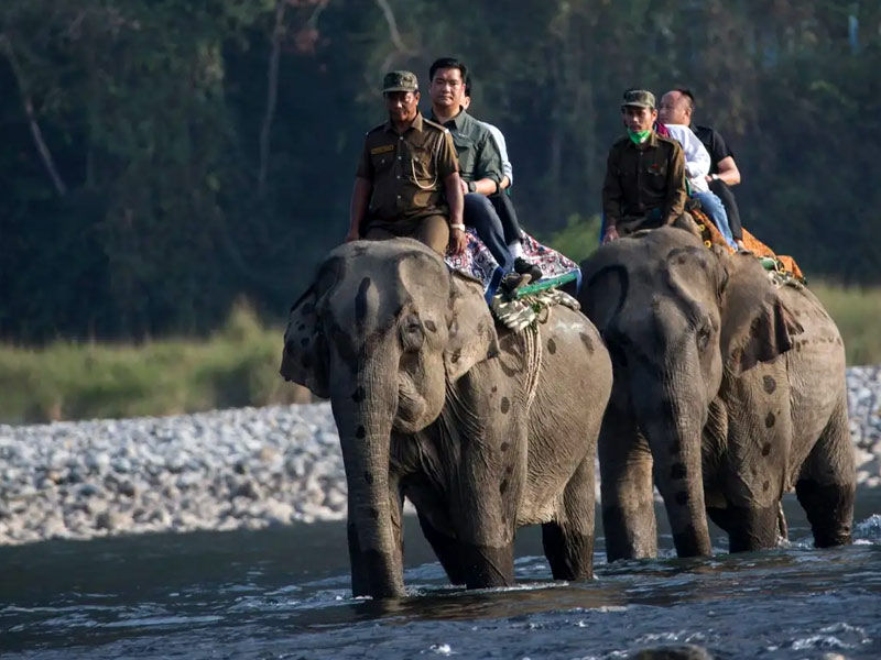
Within the park, there are a few Lisu tribal people settlements. The majority of the Lisus, on the other hand, are found beyond the park’s eastern border, near India’s international border with Myanmar. Around the park, there are also Chakma, Tangsa, and Singpho settlements.
The Namdapha National Park in Arunachal Pradesh is the largest protected area in the eastern Himalayas, spanning approximately 2,000 square kilometres and home to a diverse range of flora and fauna. A five-day hike through a breathtaking rainforest begins once you reach the park’s last motorable point. While there are no passes to cross, the changing topography and thrilling river crossings provide excitement.
The Namdapha trek begins in Deban, Arunachal Pradesh, and lasts 65 kilometres. To get to Deban, fly to Dibrugarh, the nearest major city in Assam. Drive to Miao, which will take you about five to six hours. You can spend the night at Namdapha Eco Camp and then travel the next day to Deban, another 25 kilometres away. If you do this trek with a guide, which is highly recommended, they will transport you from Dibrugarh.
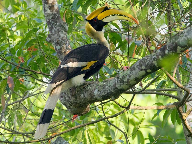
The final day of the trek includes some exciting challenges and sights. You climb from your campsite through the forest, passing through a popular birding area where you can see beautiful birds such as the rufous vented yuhinia, black-throated parrotbill, white crested laughing thrush, and many others. The descent then begins down a slick slope. Soon after, you begin climbing again and arrive at Miao Vijaynagar Road, the trek’s endpoint.
You’ll drive to Miao, where you can spend the night in a camp.
Level of Difficulty
The Namdapha trek is a medium-intensity hike that requires seven to eight hours of walking each day. Traversing a changing terrain, ascending and descending, and battling leeches and a slippery trail if it rains are all challenges.
Because this is a multi-day trek that follows unmarked trails and traverses a variety of terrains, it is best to go with a trekking company. Getting to the ‘basecamp’ also necessitates driving long distances from Dibrugarh, which would necessitate hiring your vehicle if you are not a local. Use the services of a trekking agency to avoid the hassle.
The journey?
The Namdapha Trek takes nine days to complete. Though the actual trekking trail begins in Deban and takes five days to complete, it only takes two days to travel from Dibrugarh to Deban and back. This is the path you will take once you arrive in Deban:
Embeong – Baloo Khat – Deban – Hornbill – Firmbase camp – Deban


