


The Warwan Valley is a Himalayan sub-valley and a tehsil in India’s union territory of Jammu and Kashmir, located in the Kishtwar District. The Valley is 68 kilometers (42 miles) northeast of Kishtwar and 150 kilometers (93 miles) from Srinagar, Jammu, and Kashmir’s summer capital.
It is under the jurisdiction of the Kishtwar district in Jammu and Kashmir’s Marwah Sub-Division.
The Warwan Valley trek is one of our country’s most beautiful. There is no other trek that can compare to the experience you will have on this one. And there will be no other trek that comes close to this one. This may appear to be a bold statement to make. However, our founders, who first investigated this trek in 2015, continue to support it.
After all, even for Kashmir, the Warwan Valley is breathtaking. Even if you’ve visited Kashmir before and seen Sonamarg, Gulmarg, Pahalgam, and the other sights the valley have to offer, the scenery in Warwan Valley will take your breath away. It’s one-of-a-kind in the area.
The Warwan River drains the Warwan Valley. The Batkot and Gumbar streams come together to form this river. In the lower reaches of the valley, the river is known as Marusudar, and it is the largest right tributary of the Chenab River, which is a tributary of the Indus River system.
The Warwan Valley has gone through three distinct phases of folding in polyphase deformation, according to a geological mapping survey. In the southern part of the valley, the Palaeozoic-Mesozoic succession emerges, while the eastern limb is overturned.
A floristic survey conducted in 2015 found 285 plant species belonging to 191 genera in 60 families, covering about 75% of the valley. Twenty-six of these plant species are classified as endangered. The valley’s main flowering season is from June to July. The valley is abundant in medicinal plants, which are used to treat local ailments.
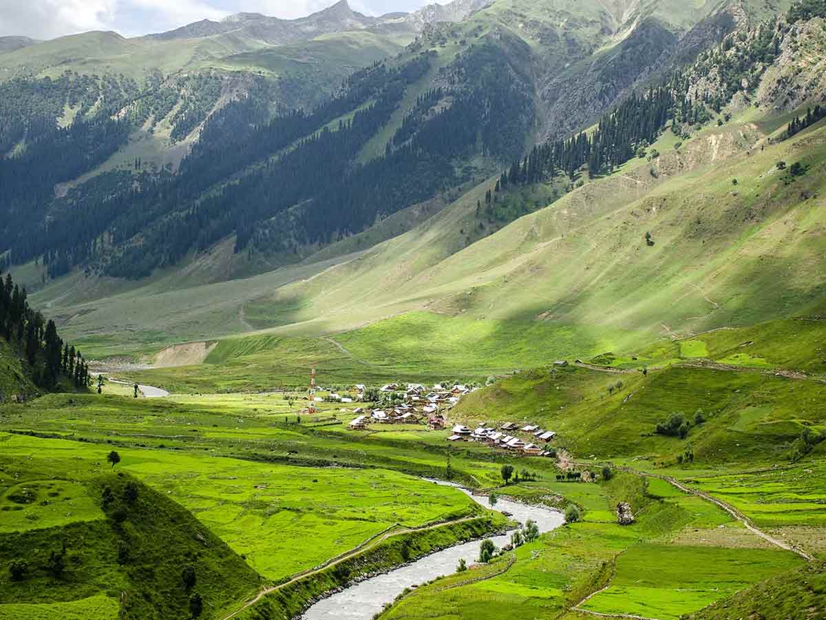
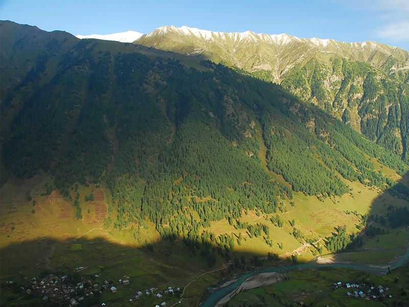
The valley’s remoteness and isolation add to its natural beauty. Even most Kashmiris have never seen this side of the valley.
The crossover trail adds to the uniqueness of entering Warwan Valley. It begins in the Trans-Himalayan region of Panikhar, among barren, purplish mountains. Among these stark mountains, the trail passes through an oasis, river deltas, wildflower meadows, and glaciers. It creates hauntingly beautiful scenes. The effect is striking as the trail slowly moves into the lush greenery of Kashmir after days of being surrounded by desert mountains.
Accessibility
Warwan Valley is one of Jammu and Kashmir’s most remote valleys, with limited access to proper roads, communication facilities, and electricity. Due to heavy snowfall, the valley is cut off for about six or seven months each year. The valley’s Margi village was completely destroyed by fire in 2016.
When it comes to exploring the Himalayas, trekkers visit various regions to see various types of scenery. Summits, meadows, and glaciers draw visitors to Uttarakhand, Manali, and Ladakh. Warwan Valley is a hidden gem that provides everything in one trip.
Also Read: Gada Gushaini: A Tranquil Hillstation In the heart of Himachal Pradesh
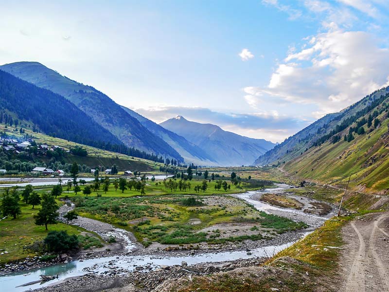
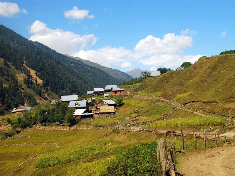
The journey begins with a breathtaking drive through Kargil and Leh to Suru Valley. For the first few days after a night in Panikhar, we pass through vast river delta basins, vibrant meadows, massive glacial lakes, moraine sections, and silky streams. After crossing the massive pass, we walk through the massive Kaintal glacier and into the Kashmir Valley. We walk through some ancient villages in Kashmir on the last day of the trek.
The larger-than-life spaces, traversing next to massive streams, bone-chilling river crossings, walking through quaint villages, walking on ice, views of glaciers, and walking on steep ridges are some of the alluring highlights here. Also, listen out for the golden-brown rodent (marmot) calling to you, and don’t miss the wagtails’ dance. It’s a sight to behold. The things we see on the Discovery channel come to life here if you pay close attention.
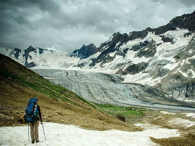
During the crossover, you will have the opportunity to partake in what we believe to be Kashmir’s greatest adventure. It’s a fantastic adventure because, aside from the breathtaking scenery, the trek offers plenty of thrills. The previous day seemed to go on forever, with a difficult climb up to the pass. Then there’s a 2-kilometer walk through the magnificent Bracken glacier, navigating its crevasses all the way up to its snout, where it pours over into moraines.
After a long day of trekking, getting into the glorious greenery of Warwan Valley is a gift, thanks to the trail’s high adventure.
This does, however, imply that this trek is not for everyone. It’s the most beautiful trek you’ll ever do, but it’s also the most difficult. Not only are you walking nearly 20 kilometers every day, but there are also difficult sections to navigate, such as glacier walks, moraines, and overhangs above the river. To participate in this trial, you must be extremely fit and have prior high-altitude trekking experience.


