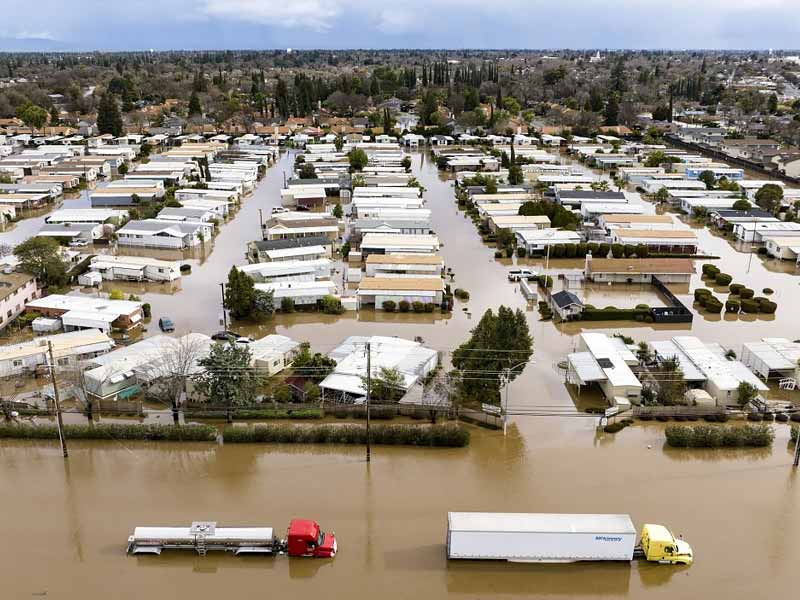
A strong storm bringing record-breaking rainfall, severe flooding, and landslides is currently sweeping across California. The hardest-hit areas are from Santa Barbara to Los Angeles, where several locations saw 4–6 inches of rain, and some areas saw up to 10 inches in the previous day. As it approaches the Oregon–California border on Tuesday, it is anticipated to weaken. Tuesday morning will bring sporadic showers and thunderstorms after the rainy night in Los Angeles.
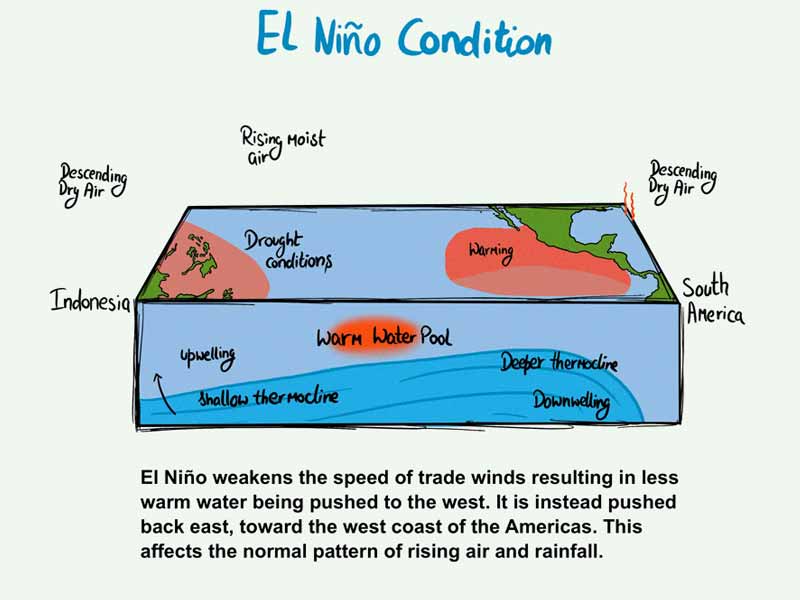
Scientists believe that El Niño and climate change are linked to the powerful storm that is currently affecting California, even though it is challenging to link a single weather event to either.
The effects of El Niño usually become apparent in the first quarter of the year, and this week’s Southeast weather is due to the jet stream crossing the southern tier of the US.
An atmospheric river: what is it?

For good reason, the National Oceanic and Atmospheric Administration calls these systems “rivers in the sky.” The atmospheric rivers (ARs) that affect the western United States are characterised by long streams of moisture in the atmosphere that are typically 250–375 miles wide. These streams are supercharged by water vapour that evaporates off the Pacific Ocean and are carried by other weather systems from the tropics or subtropics.
Strong atmospheric rivers have the capacity to hold more than 15 times the amount of water vapour carried by the average river, which is comparable in flow to the Mississippi River’s mouth. When ARs land, that moisture is released as rain or snow, and the ensuing storms can be very beneficial or very destructive, depending on the storm’s size, timing, and intensity.
Bomb cyclone
By forcing ARs from the Pacific to the coast, these low-pressure storm systems contribute to their creation. A bomb cyclone is a storm that is strengthening but experiencing a sharp drop in pressure. Bomb cyclones have the ability to produce the worst weather near their edges, unlike hurricanes or other storms where the centre is strongest.

“Bombogenesis,” a term used by meteorologists to describe pressure drops that correspond with strengthening at various latitudes, is the process that gives rise to bomb cyclones. Collisions between warm and cold air result in bombogenesis. In addition to having the ability to create atmospheric rivers, these so-called “extra-tropical cyclones” can also intensify them.
Also read: 5 Delectables Dishes Made With Besan
Why are people worrying so much?
The storms this week have caused anxiety among officials and locals due in part to their timing. When systems are already flooded and soils are saturated, the simultaneous systems have a greater ability to cause havoc and pack a bigger punch.

There is another terrifying storm in the forecast, and forecasters have warned people all over the state to get ready for potentially deadly and destructive weather. Equipped with overlapping hazards, the massive system is poised to cause havoc throughout the state. These hazards include strong winds, torrential downpours, tumultuous surf along the coast, and whiteout conditions in the mountains.


